Hello All!!!
Today I will write in English, just for a change! 😀
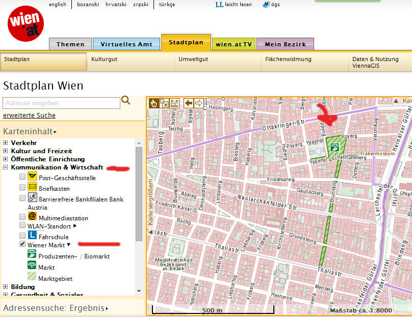
I would like to shortly speak about the absolutely super great map that exists on the official website about Vienna city, https://www.wien.gv.at/stadtplan/.
It is extremely helpful and it saves you from a lot of googling when for example you want to find a swimming pool close to the place you live. It works like this. The map has 7 big categories. Transportation (parking, carsharing, taxi etc), Culture and Freetime (sightseeing, museums, open sport facilities, grillspots), Open Facilities (churches, police stations), Communication and Economy (post offices, open markets), Education (libraries, universities, public schools), Health and Social (hospitals, pharmacies, consultation centers) and Clean City (recycling spots, services for disposal of special or dangerous material such as a laundry machine).
Here is a couple of examples, when the Stadtplan really helped me. I wanted to visit a local open market to buy cheese and meat, which I cannot find in the supermarkets. Clicking the Category of „Kommunikation & Wirtschaft“ and then the subcategory „Wiener Markt“, I found a local open market in the 16th suburb.
I personally spent more than an hour clicking on all the options and checking what is around my home! It is very interesting, not to say, entertaining!
Have fun!
Alexandra